INSTRUCTOR: Eric D. Carlson, P.G.
DISCIPLINE: Field Courses
COURSE LENGTH (DAYS): 2 Days (Including a 2-Hour Webinar)
CEUS: 1.8
AVAILABILITY: In-House
ATTEND AN UPCOMING CLASS:
Contact SCA’s Training Department at training@scacompanies.com to schedule an In-House field course.
WHO SHOULD ATTEND:Engineers, landmen, managers, and salesmen will take away mental images from outcrops that will help them to understand Oilpatch geology. For geoscientists, walking in and around seismic line-sized outcrops and canyons will spur new ideas and constrain existing models.
COURSE DESCRIPTION: Big Bend is unique. It is the only place in North America where all the major types of oilfield trapping mechanisms are easily identified. Four types of mountain-building, and deposition of sandstone and carbonates are the results of continental drift and heat flow in the Earth’s crust. Engineers, Landmen, Managers, and Salesmen will take away mental images from outcrops that will help them to understand Oilpatch geology. For Geoscientists, walking in and around seismic line-sized outcrops and canyons will spur new ideas and constrain existing models.
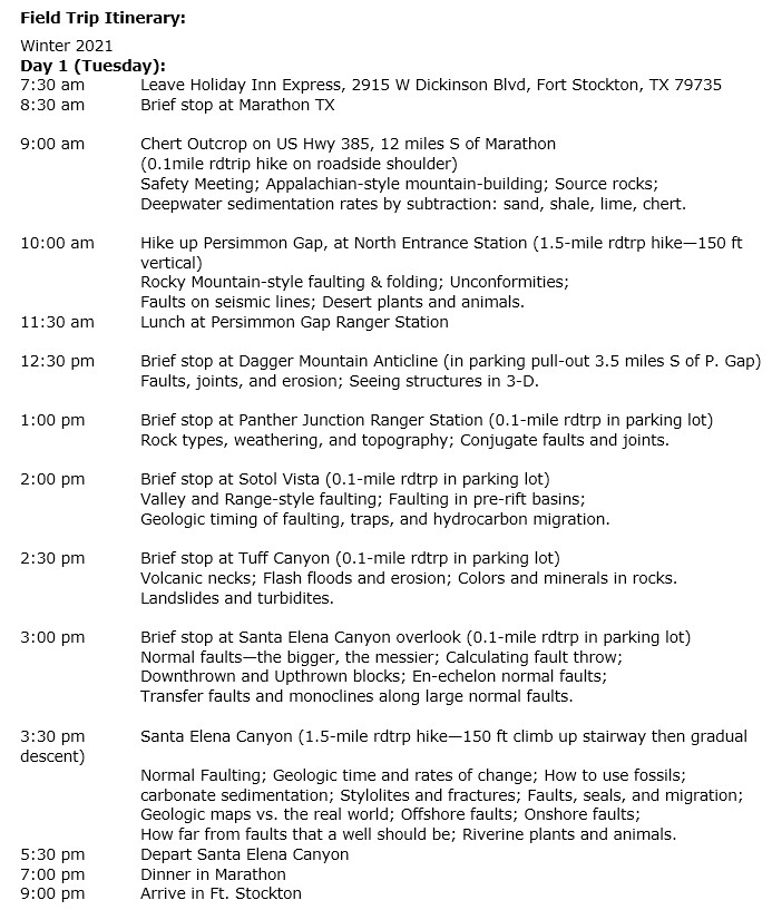
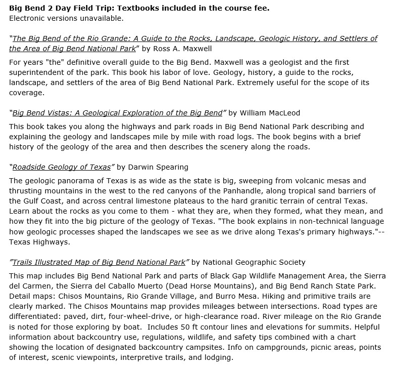
The course fee includes 3 guidebooks and 2 large maps, and an orientation webinar before the trip. The tectonics and history of the park will be discussed. Each of the 2 days in the park will feature 5 hours of contact with the rocks. Outcrops are near the road. At outcrops, analogues to conventional and unconventional reservoirs will be noted. Structural analogues include the US Gulf Coast, the Oklahoma STACK Play, the Permian Basin, foreland basins of the Rockies, the Cantarell Complex, and the North Sea. Stratigraphic analogues are Gulf Coast turbidites, Cretaceous foreland sandstones, Morrow Sands, swamps, Gulf Coast Edwards and Austin Chalk plays, and giant reservoirs in the Persian Gulf. In four 1.5-mile roundtrip hikes, the trip will visit all major ecosystems of Big Bend National Park: Riverine, Desert Floor, Scrub Forest, and Chisos Rim. Nine other roadside stops will complete the course. Participants will begin each day from accommodations north of the park and return after dark. The field course size is limited to 25 attendees.
LEARNING OUTCOMES:
- Normal faults, reverse faults, and strike-slip faults will be observed at a distance and close-up, to discern major and subtle details which affect hydrocarbon trapping and well placement. These faults are seen in large cliffs that are the size of seismic lines; yet are available to the touch.
- Three types of fluvial sand bars, caused by differing bed loads and stream gradients, will be observed to help imagine their thicknesses and lateral geometries underground as reservoirs. Fossil riverbeds, having scour surfaces and near-vertical walls, will be seen in cross-section.
- Deepwater chert (novaculite) hogbacks and adjacent fractured black shale will be studied for their prospectivity. Flash flood channels will be compared to turbidites and submarine canyons in outcrop.
- Massive-bedded and thin-bedded limestone and marl will be examined for factors influencing horizontal and vertical permeability and fracture density. Subsurface conventional and unconventional reservoir analogues will be discussed.
- Outcrops of fossil river deltas, deposited in shallow marine conditions, will be discussed.
- Outcrops of shale that were deposited in deep marine, shelf margin, and subaerial environments will be diagnosed by their color, plasticity, silt content, and hydrocarbon-generating/preserving abilities. Dinosaur localities will be noted. Subsurface reservoir analogues will be discussed.
- Enough time will be spent hiking in each ecozone of the park to appreciate their fauna and flora.