Dynamic Data Services (DDS)
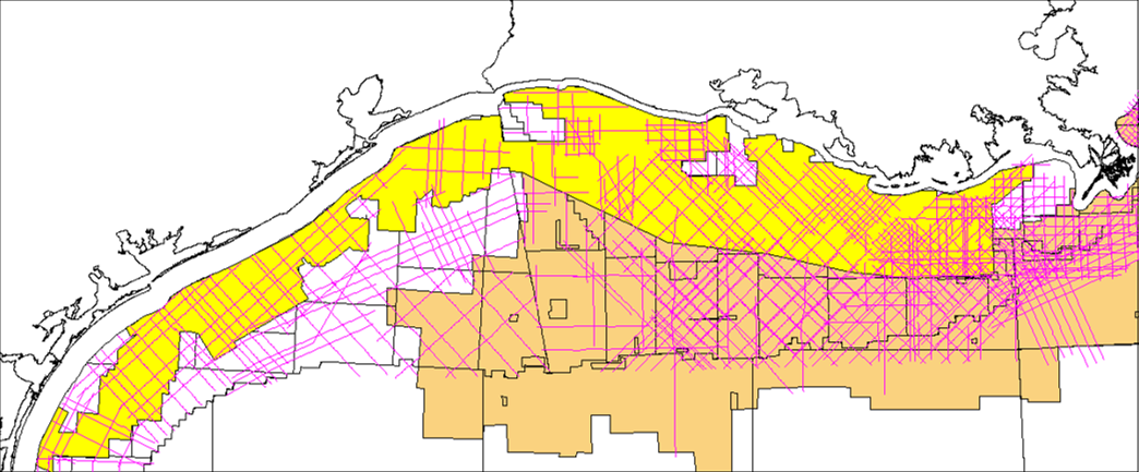
DDS and SCA are working a joint venture project to screen potential carbon storage offshore in the Gulf of Mexico. The project will deliver a geological and commercial ranking of potential carbon storage sites in the federal waters of Texas and Louisiana. The analysis is based on detailed structural and stratigraphic interpretation of regional 3D seismic within 50 miles of the coastline and incorporates economic criteria that ranks potential sites on size and cost of storage.
DDS and SCA are working a joint venture project to screen potential carbon storage offshore in the Gulf of Mexico. The project will deliver a geological and commercial ranking of potential carbon storage sites in the federal waters of Texas and Louisiana. The analysis is based on detailed structural and stratigraphic interpretation of regional 3D seismic within 50 miles of the coastline and incorporates economic criteria that ranks potential sites on size and cost of storage.
CCS AOI parameters: 50 miles from shore and 15,855 miles2 (41,064 km2) of currently available 3D seismic data.
Project Foundation
The foundation of the project is a detailed structural and stratigraphic interpretation of a regional 3D seismic volume within 50 miles of the coastline. Our existing seismic stratigraphic framework has been developed through 5 years of detailed 3D mapping on the Western Louisiana shelf, which will now be extended to offshore Texas. Ten major flooding surfaces have been identified on the 3D data within the 4000’-12,000’ target interval and tied to public domain well biostratigraphy.
The foundation of the project is a detailed structural and stratigraphic interpretation of a regional 3D seismic volume within 50 miles of the coastline. Our existing seismic stratigraphic framework has been developed through 5 years of detailed 3D mapping on the Western Louisiana shelf, which will now be extended to offshore Texas. Ten major flooding surfaces have been identified on the 3D data within the 4000’-12,000’ target interval and tied to public domain well biostratigraphy.
Objective
Identify the largest sealed pore volumes in both existing hydrocarbon fields and unconfined aquifers. The engineering screening study will determine key sensitivities to lowest cost storage per mt of CO . Analyses will include analog projects, reservoir characterization, pressure and phase behavior, capex and opex and fiscal considerations. The final ranking phase of the project will integrate the identified largest pore volumes with the engineering sensitivities to assess the most commercially viable targets.
Identify the largest sealed pore volumes in both existing hydrocarbon fields and unconfined aquifers. The engineering screening study will determine key sensitivities to lowest cost storage per mt of CO . Analyses will include analog projects, reservoir characterization, pressure and phase behavior, capex and opex and fiscal considerations. The final ranking phase of the project will integrate the identified largest pore volumes with the engineering sensitivities to assess the most commercially viable targets.
Deliverables
- Immediate access to a volume of 15,000 square miles of 3D seismic.
- On-going regional geological interpretation.
- Engineering and commercial sensitivities to lowest cost per ton storage.
- Ranking of top potential storage sites.
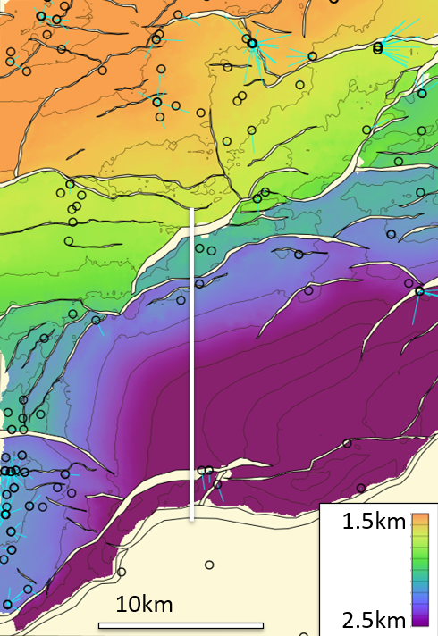
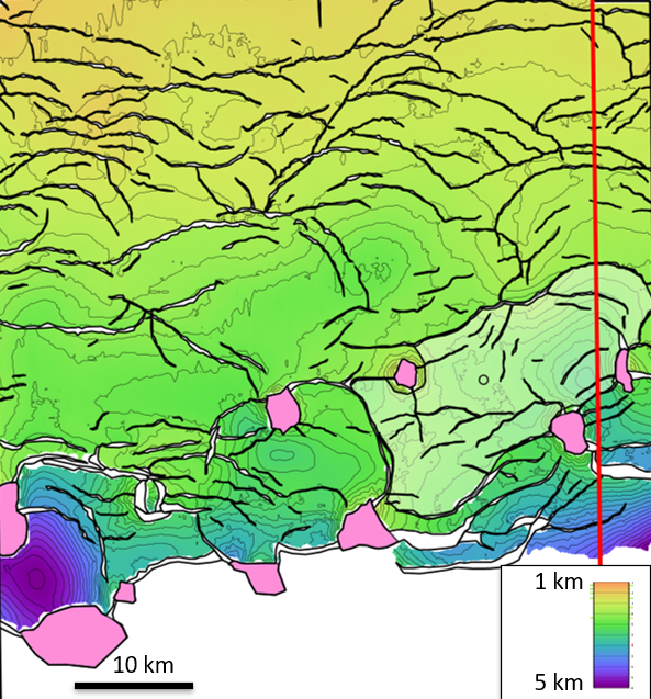
Example from Texas:
Intra Middle Miocene Depth Structure
Intra Middle Miocene Depth Structure
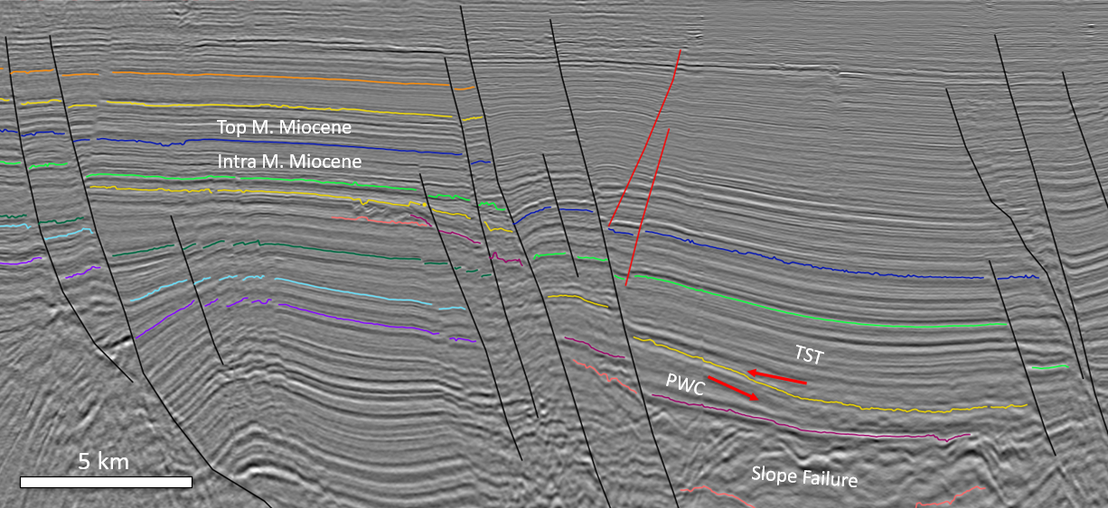
Seismic data example from Texas showing Intra Miocene interpretation
Example from Louisiana:
Intra Upper Miocene Depth Structure
Intra Upper Miocene Depth Structure
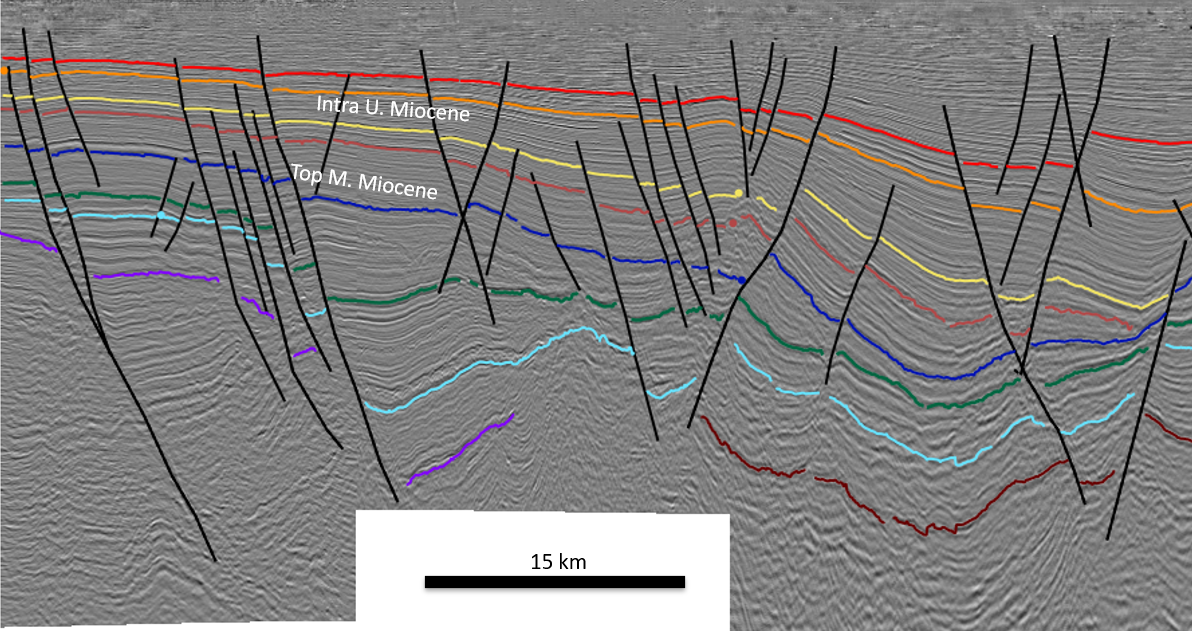
Seismic data example from Louisiana showing Intra Miocene interpretation
Learn more by viewing the Gulf of Mexico CCS Project brochure.
